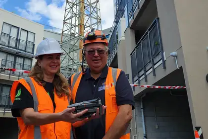
Associate Professor Renata Jadresin-Milic from Unitec and Professor Regan Potangaroa from Massey capturing drone footage from outside the drop zone of the shot tower.
Massey’s School of the Built Environment (SBE) recently partnered with Auckland City Council and Unitec’s School of Architecture to conduct an urgent drone scan of the historic Colonial Ammunition Company shot tower in Mount Eden, Auckland, before it was demolished.
The structure was built in around 1916 to produce small shot balls from free-falling molten lead. It was the only shot tower still standing in Aotearoa New Zealand and was said to be the only steel-framed one in the Southern Hemisphere. The tower’s structure became unpredictable and was deemed unsafe, so was scheduled to be demolished, but before that happened, the Council and Heritage New Zealand wanted to make a record of the building and its site.
The drone scan, which was conducted by Professor Regan Potangaroa from SBE and Associate Professor Renata Jadresin-Milic from Unitec, captured detailed images and data of the tower and its surroundings.
Professor Potangaroa says the team planned the drone’s flight path to ensure they captured all the necessary angles and details, including close-up shots of any historic features or signage, as well as wider shots that placed the building in its historical context. All of this had to be achieved while working outside the 35-metre drop zone of the tower.
He says the structure was ‘one of a kind’ and due to its heritage there were no other records of it.
“To be able to help capture history by making a digital copy of the structure was pretty exciting. It’s a resource that can be used for years to come.
“Because we had such urgency to get footage, and tight parimeters to work with, we ended up using laser painting. We wanted to say goodbye to the structure and by using lasers we could do something a bit more special. It allowed you to have a bit more of a connection with the structure that you couldn’t get any other way," Professor Potangaroa says.
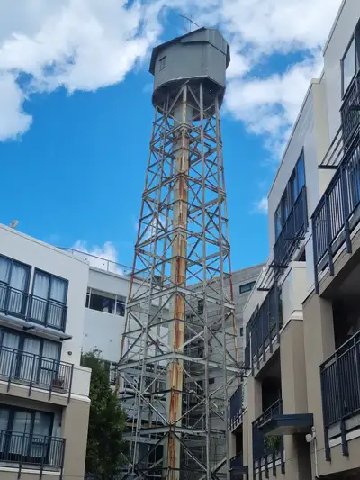
New Zealand's last remaining shot tower in Mount Eden, Auckland.
The urgency of the work arose out of concerns that the tower’s structure could collapse under the anticipated wind loads from Cyclone Gabrielle. The Council made the call to evacuate the immediate area and to proceed with plans for its demolition. This decision meant that 50 apartments needed to be evacuated, which added to the urgency to complete the scanning.
With the scanning now complete, the data is being post-processed to produce point clouds and digital copies of the shot tower. This may include a 3D model or virtual tour, which can be accessed by future researchers, historians, or interested members of the public.
By conducting this drone scan, the Council, SBE and School of Architecture are not only preserving an important piece of Auckland’s history but also demonstrating the value of using cutting-edge technology to document and understand our past.
Related news
School of Built Environment students awarded scholarships
Five students from the School of Built Environment have recently been awarded one-year tertiary scholarships for 2022 through Keystone Trust and their Key Scholarship Partners.

Team from School of Built Environment take out Global Student Challenge
A team from Massey's School of Built Environment (SBE) have won the eighth-annual Chartered Institute of Building (CIOB) Global Student Challenge.

Massey launches new School of Built Environment
Unprecedented growth and success of the construction-related programmes at Massey University has led to the establishment of the School of Built Environment on the university's Auckland campus.
