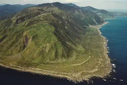
Raised beach ridges along the WLG coastline, uplifted by earthquakes over the last 5000 years. (Lloyd Homer, 1985; Turakirae Head; GNS Science Visual Media Library ID: 1274).
The two-year project is supported by the Ministry of Business, Innovation and Employment Te Pūnaha Hihiko: Vision Mātauranga Capability Fund (grant number MAUX2309) and involves a partnership between He Waka Uru Ora (Te Rūnanga o Ngā Wairiki – Ngāti Apa), Whakauae Research Services (Te Rūnanga o Ngāti Hauiti), Horizons Regional Council, InSite Archaeology and Te Kunenga ki Pūrehuroa Massey University.
In its first year, the project has already yielded positive results, exploring both the causes of the landslide event and the resulting social, cultural and environmental impacts.
Earth and environmental scientist and lead researcher from Massey, Dr Callum Rees, explains that the team are also focused on identifying how to navigate similar future events.
“We see evidence of this event preserved in the landscape, the geology, the soils, and in the stories passed down from those who lived in the area at the time. Māori have lived in this valley for generations, constantly adapting and responding to natural disasters and major floods. Their oral histories provide crucial insights for modern society, helping us to extend our limited written records of these events and informing decisions around where to place new developments,” Dr Rees says.
Project lead for Ngāti Hauiti, Utiku Potaka, says, “Ngāti Hauiti have lived in this region for centuries and have a long and intimate association with this locality. We have built up customs and traditions relating to the cultural and spiritual practices of the awa and the whenua and have had to adapt to changes in the landscape.”
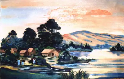
Painting of Te Hou Hou Pā 1880, on the Rangitīkei floodplain immediately downstream of where the Pūtōrino landslide occurred. (Potaka private collection provided courtesy of Utiku Potaka).
The Pūtōrino landslide is thought to have been triggered by the 1855 magnitude 8.2 Wairarapa earthquake, the biggest earthquake recorded in Aotearoa New Zealand since written records began.
Dr Rees says that given the region’s earthquake-prone nature, deeply incised river systems and weak geology, there is a risk of similar events occurring in the future.
“The earthquake uplifted parts of the Wellington coastline by up to six metres, with all kinds of sea life being thrust out of the sea before drying out and dying in the sun, just like we saw in the 2016 Kaikōura earthquake. It generated a tsunami that reached heights of up to 10-11 metres and triggered landslides throughout the lower north and upper south islands.
“We need to learn from this event and use that knowledge to better prepare for future natural disasters.”
An online story map has been developed, providing a detailed, visual overview of important elements within the project and the science behind it.
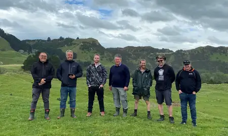
The project brings together a multifaceted team, with three primary lines of inquiry: the Ngāti Hauiti perspective, the Ngāti Apa perspective, led by Grant Huwyler and the western science perspective, led by Dr Rees.
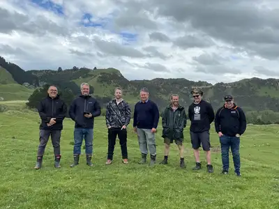
Team members (L-R): Grant Huwyler, Professor Jonathan Procter, Daniel Parker, Adjunct Associate Professor Alan Palmer, Willie McKay, Callum Rees, Matt Irwin. Photo taken by Utiku Potaka.
“This project has given us an opportunity to engage with Massey and experts like Dr Callum Rees. We can be right at the forefront with the scientific knowledge and match it up with our traditional knowledge systems and rebuild ourselves as kaitiaki,” Mr Huwyler says.
The next steps leading into the remaining 12 months of the project will include wānanga that bring together project partners, experts and members of the community to share knowledge and deepen understanding of the event. This will allow for the dissemination of research findings, with a particular focus on engaging local rangatahi.
A short project video has been created to introduce the public to the project, which can be viewed on the Pūtōrino e Rua website here.
About Pūtōrino e Rua:
The Pūtōrino e Rua logo depicts two stories. In the first story, the image depicts two Pūtōrino in the embrace of a central figure. The space between the two Pūtōrino depicts the land and the river. The central figure embracing the Pūtōrino depicts Ruaumoko, who is the atua associated with earthquakes. The second story is of two figures, each holding a Pūtōrino, and facing each other. This more directly represents the two kōrero, one figure depicts Tuariki and the other depicts Matangi. Designed by Te Mana-o-Tawhaki Henare Huwyler.
Project short title: Pūtōrino e Rua
Long title: Te Horo I Whakakotahi a Pūtōrino e Rua, literally meaning ‘The Landslide that joined two Pūtōrino”. Figurative meaning is discovering the past, present and future impact on land, water and people caused by the Pūtōrino landslide.
Related news
Partnering to encourage young people into the primary industries
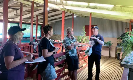
Encouraging high school students to pursue a career in the primary industries was the aim of a recent educational day with a group of North Island high school teachers.
Pūtōrino e Rua partnership receives Te Pūnaha Hihiko: Vision Mātauranga Capability funding
A multifaceted team led by Massey’s Dr Callum Rees, Utiku Potaka of Ngāti Hauiti and Grant Huwyler of Ngāti Apa has been awarded $250,000 in funding from the Te Pūnaha Hihiko: Vision Mātauranga Capability Fund.
Two Massey projects receive funding from Te Pūnaha Hihiko: Vision Mātauranga Capability Fund
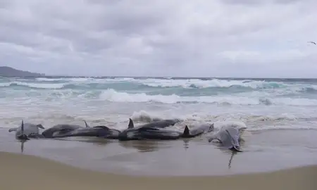
Professor Isabel Castro and Professor Karen Stockin are involved in projects that address conservation and mātauranga Māori, in partnership with Māori collaborators.